Aircraft Noise Technical Report
Cessna Citation Sovereign · Other Documents
Overview
This document is a technical report focused on the aircraft noise exposure related to the Key West International Airport's Bypass Taxiway, Apron Expansion, and Security Fencing Environmental Assessment. It outlines the regulatory background, methodology for noise analysis, and results of noise exposure assessments. The report utilizes the FAA's Aviation Environmental Design Tool (AEDT) to evaluate potential noise impacts and provides detailed data on aircraft operations, including those of the Cessna Citation Sovereign. This document is intended for airport planners, environmental scientists, and aviation stakeholders interested in understanding the noise implications of airport operations.
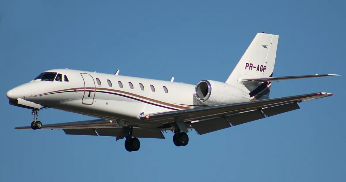
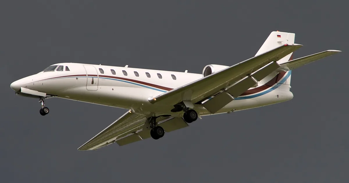
- The Cessna Citation Sovereign had 655 operations in 2019, projected to increase to 686 in 2024 and 730 in 2029.
- The noise analysis uses the FAA's AEDT to develop DNL contours for assessing noise impact.
- The DNL is a 24-hour time-weighted sound level expressed in A-weighted decibels, crucial for evaluating noise exposure.
- The report forecasts a total of 57,087 operations in 2024 under the No Action scenario, increasing to 58,787 with the Proposed Action.
- The total area within the DNL 65 and greater contour is approximately 400 acres as of 2019.
Document
Source
Originally published by eyw.com. Sprinkle hosts a reference copy with an added summary, specifications and searchable full text.
Document details
- Type
- Other Documents
- Year
- 2020
- Pages
- 34
- File size
- 1.9 MB
- Publisher
- eyw.com
Common. Rarer than 1% of the aircraft models we track.
Most owners only have the POH. Here's the essential set for the Cessna Citation Sovereign.
- Pilot's Operating Handbook / AFM
- Checklist
- Maintenance Manual
- Parts Catalog (IPC)
- Systems & Wiring
- Service Bulletins
- Type Certificate (TCDS)
Cessna Citation Sovereign for sale now


Free — save the Citation Sovereign to your watchlist and track it in one place.
More Cessna Citation Sovereignmanuals & documents
- Citation SovereignSpecifications
- 2008 Cessna Citation Sovereign S/N 680-0250Systems Description
- 2008 CITATION SOVEREIGN Specifications and SummarySpecifications
- 2007 CITATION SOVEREIGNChecklist
- CESSNA CITATION SOVEREIGNSystems Description
- 2006 Citation SovereignSystems Description
- 2006 CITATION SOVEREIGNSpecifications
- Cessna Citation C-680 (Sovereign)Flight Manual
- Flammability Testing & Certification ServicesType Certificate
If you fly the Cessna Citation Sovereign, you may also be researching these.
In this document
Introduction
The report presents an analysis of aircraft noise exposure at Key West International Airport, prepared to comply with FAA regulations. It describes the methodology used for noise analysis, including the use of the AEDT to develop noise exposure contours based on aircraft operations.
Regulatory Guidelines and Noise Model
The noise analysis follows FAA guidelines and employs the AEDT to produce noise contours that indicate areas of equal day-night average sound level (DNL). The DNL is a key measure of noise impact, accounting for increased sensitivity to nighttime noise.
2019 Aircraft Operations and Fleet
The report details the aircraft operations modeled for 2019, totaling 53,052 operations, with an average of 145 operations per day. It includes a breakdown of operations by aircraft type, including the Cessna Citation Sovereign, which had 655 operations.
2024 Aircraft Operations
Forecasts for 2024 indicate an increase in aircraft operations to 57,087 under the No Action scenario and 58,787 under the Proposed Action, with the Cessna Citation Sovereign projected to have 686 operations.
2029 Aircraft Operations
The report projects 2029 operations to total 59,527 under the No Action scenario and 61,227 under the Proposed Action, with the Cessna Citation Sovereign expected to have 730 operations.
Full document text
APPENDIX F Noise Analyses F.1 | AIRCRAFT NOISE TECHNICAL REPORT F.2 | CONSTRUCTION NOISE ANALYSIS APPENDIX F.1 Aircraft Noise Technical Report Aircraft Noise Technical Report Kew West International Airport Bypass Taxiway, Apron Expansion, and Security Fencing EA Prepared by: KB Environmental Sciences, Inc. Draft –April 30, 2020 1 Introduction This technical report presents the aircraft noise exposure for the Key West International Airport (EWY) Bypass Taxiway, Apron Expansion, and Security Fencing Environmental Assessment (EA). The noise analysis was prepared to meet the requirements of Federal Aviation Administration (FAA) Order 1050.1F, Environmental Impacts: Policies and Procedures and FAA Order 5050.4B, National Environmental Policy Act (NEPA) Implementing Instructions for Airport Actions. The following describes the regulatory background, noise analysis methodology, noise model input data and noise exposure results. Regulatory Guidelines and Noise Model The noise analysis was developed using the FAA’s Aviation Environmental Design Tool (AEDT) Version 3b. The AEDT is the required tool to evaluate potential noise impacts from actions subject to NEPA. The AEDT produces aircraft noise contours that delineate areas of equal day-night average sound level (DNL). The DNL is a 24-hour time-weighted sound level that is expressed in A-weighted decibels. The FAA and other federal agencies use DNL as the primary measure of noise impact because: it correlates well with the results of attitudinal surveys regarding noise; it increases with the duration of noise events; and, it accounts for an increased sensitivity to noise at night by increasing each noise event that occurs during nighttime hours (i.e., 10:00 pm to 6:59 am) by 10 dB. The AEDT works by defining a network of grid points at ground level around an airport. It then selects the shortest distance from each grid point to each flight track and computes the noise exposure generated by each aircraft operation, along each flight track. Corrections are applied for atmospheric acoustical attenuation, acoustical shielding of the aircraft engines by the aircraft itself, and aircraft speed variations. The noise exposure levels for each aircraft are then summed at each grid location. The cumulative noise exposure levels at all grid points are then used to develop noise exposure contours for selected values (e.g. DNL 65, 70 and 75). Guidelines regarding the compatibility of land uses within various DNL contour intervals are specified in Appendix A of 14 Code of Federal Regulations (CFR) Part 150. As shown in Table 1, the FAA identifies, as a function of yearly (365-day average) DNL values, land uses which are compatible and land uses which are not compatible in an airport environs. The FAA has determined that the all the land uses listed in the table are normally compatible with aircraft noise exposure below the DNL 65 contour. When evaluating land use compatibility, attention is therefore focused on uses within the DNL 65 contour. 2 Table 1 – FAA Land Use Compatibility Guidelines Land Use DNL expressed in dB(A) Below 65 65–70 70–75 75–80 80–85 Over 85 Residential Residential, other than mobile homes and transient lodgings Y N(1) N(1) N N N Mobile home parks Y N N N N N Transient lodgings Y N(1) N(1) N(1) N N Public Use Schools Y N(1) N(1) N N N Hospitals and nursing homes Y 25 30 N N N Churches, auditoriums, and concert halls Y 25 30 N N N Governmental services Y Y 25 30 N N Transportation Y Y Y(2) Y(3) Y(4) Y(4) Parking Y Y Y(2) Y(3) Y(4) N Commercial Use Offices, business and professional Y Y 25 30 N N Wholesale and retail—building materials, hardware and farm equipment Y Y Y(2) Y(3) Y(4) N Retail trade—general Y Y 25 30 N N Utilities Y Y Y(2) Y(3) Y(4) N Communication Y Y 25 30 N N Manufacturing and Production Manufacturing, general Y Y Y(2) Y(3) Y(4) N Photographic and optical Y Y 25 30 N N Agriculture (except livestock) and forestry Y Y(6) Y(7) Y(8) Y(8) Y(8) Livestock farming and breeding Y Y(6) Y(7) N N N Mining and fishing, resource production and extraction Y Y Y Y Y Y Recreational Outdoor sports arenas and spectator sports Y Y(5) Y(5) N N N Outdoor music shells, amphitheaters Y N N N N N Nature exhibits and zoos Y Y N N N N Amusements, parks, resorts and camps Y Y Y N N N Golf courses, riding stables and water recreation Y Y 25 30 N N Notes: SLUCM=Standard Land Use Coding Manual. Y (Yes) = Land Use and related structures compatible without restrictions. N (No) = Land Use and related structures are not compatible and should be prohibited. NLR = Noise Level Reduction (outdoor to indoor) to be achieved through incorporation of noise attenuation into the design and construction of the structure. 25, 30, or 35=Land use and related structures generally compatible; measures to achieve NLR of 25, 30, or 35 dB must be incorporated into design and construction of structure. (1) Where the community determines that residential or school uses must be allowed, measures to achieve outdoor to indoor Noise Level Reduction (NLR) of at least 25 dB and 30 dB should be incorporated into building codes and be considered in individual approvals. Normal residential construction can be expected to provide a NLR of 20 dB, thus, the reduction requirements are often stated as 5, 10 or 15 dB over standard construction and normally assume mechanical ventilation and closed windows year-round. However, the use of NLR criteria will not eliminate outdoor noise problems. (2) Measures to achieve NLR 25 dB must be incorporated into the design and construction of portions of these buildings where the public is received, office areas, noise sensitive areas or where the normal noise level is low. (3) Measures to achieve NLR of 30 dB must be incorporated into the design and construction of portions of these buildings where the public is received, office areas, noise sensitive areas or where the normal noise level is low. (4) Measures to achieve NLR 35
Show full textShow less
dB must be incorporated into the design and construction of portions of these buildings where the public is received, office areas, noise sensitive areas or where the normal level is low. (5) Land use compatible provided special sound reinforcement systems are installed. (6) Residential buildings require an NLR of 25. (7) Residential buildings require an NLR of 30. (8) Residential buildings not permitted. Source: 14 CFR Part 150 3 Section 1 - Affected Environment In the development of DNL contours, the AEDT uses both default and airport-specific factors. The default factors include engine noise levels, thrust settings, aircraft arrival and departure flight profiles and aircraft speed. The airport-specific factors include the number of aircraft operations, the type of aircraft, runway use, the assignment of aircraft operations to flight tracks and operational time (day/night) data. This section includes the airport-specific factors used in modeling the existing 2019 DNL contours. 2019 Aircraft Operations and Fleet The aircraft operations1 modeled for 2019 were obtained from the Aircraft Operations Forecast and Fleet Mix Memorandum prepared by Ricondo & Associates, Inc. These data, by aircraft category, are provided in Table 2. As shown, the 2019 annual operations totaled 53,052, an average of approximately 145 operations per day. Table 2: 2019 Annual Aircraft Operations For the purposes of preparing DNL contours, operational data were segregated by aircraft type. The FAA’s Traffic Flow Management System Count (TFMSC) data for fiscal year 2019 was used to develop the AEDT aircraft fleet mix. TFMSC data provides information on traffic counts by airport and includes the aircraft types operating at that airport. The TFMSC data for EYW was reviewed and each aircraft type was assigned the corresponding AEDT aircraft type. As required for use in the AEDT, annual aircraft operations were converted to annual average-day operations. Limited data is available for the times of day of aircraft operations. For conservative planning purposes, the itinerant operations2 were modeled with fifteen percent (15%) occurring at night (10:00pm – 6:59am) and local operations modeled five percent (5%) at night. The 2019 modeled aircraft fleet of itinerant and local operations are provided in Tables 3 and 4 respectively. Runway Layout and Use EYW has one runway, Runway 9/27, which is 5,075 feet long and 100 feet wide that includes 274 feet of pavement reclassified as runway pavement at the Runway 9 end in 2017. Although the western 274 feet of pavement is available for aircraft departures, the runway’s parallel taxiway does not serve the end of the available pavement. Aircraft using the full departure length of Runway 9 must back taxi 274 feet to the runway end on the runway itself. Based in input from EYW ATCT manager, for modeling purposes, it was estimated that in 2019 ten percent (10%) of aircraft departing Runway 9 back taxied to the Runway 9 end. The remaining ninety percent (90%) depart from the Taxiway B intersection. Overall, eighty percent (80%) of the operations were modeled on Runway 9 and twenty percent (20%) on Runway 27. 1 An aircraft operation is defined as one arrival or one departure. 2 An itinerant operation is defined as an aircraft departure where the aircraft leaves the airport vicinity and lands at another airport, or an aircraft landing where the aircraft arrives from another airport. Local operations are primarily aircraft touch-and-go training operations or those that remain within the local airspace for the duration of the flight. Year Air Carrier Air Taxi General Aviation Military Total 2019 15,282 4,831 32,419 520 53,052 Source: Aircraft Operations Forecast and Fleet Mix Memorandum, Ricondo, 2-10-2020. 4 Table 3 - 2019 Modeled Aircraft Operations - Itinerant Aircraft Category Aircraft Type(s) AEDT ANP ID Annual Operations Average Annual Day Day Night Total AC/AT Narrowbody Boeing 737-700 737700 2,405 5.60 0.99 6.59 AC/AT Large Regional Jet Embraer ERJ 175 EMB175 4,635 10.79 1.90 12.70 Embraer ERJ 170 EMB170 1,917 4.46 0.79 5.25 Bombardier CRJ-700 CRJ9-ER 674 1.57 0.28 1.85 AC/AT Turboprop Saab SF 340 SF340 6,818 15.88 2.80 18.68 Cessna 208 Caravan CNA208 3,270 7.62 1.34 8.96 ATR 42/72 DHC830 394 0.92 0.16 1.08 GA Jet Learjet 35/40/45/55/60/75 LEAR35 1,512 3.52 0.62 4.14 Citation Mustang, Phenom 100/300 CNA510 1,199 2.79 0.49 3.28 Cessna 560 Citation XLS CNA560XL 1,158 2.70 0.48 3.17 Cessna Citation Jet CNA500 1,106 2.58 0.45 3.03 Cessna 550, Beechjet 400 CNA55B 903 2.10 0.37 2.47 Challenger 300/600 CL600 750 1.75 0.31 2.05 Cessna Citation Sovereign/Latitude CNA680 655 1.53 0.27 1.79 Cessna 560 Ultra/Encore CNA560U 495 1.15 0.20 1.36 Cessna 750 Citation X, Falcon 2000 CNA750 354 0.82 0.15 0.97 Dassault Falcon 900 FAL900EX 344 0.80 0.14 0.94 Cessna 525 Citation CJ4 CNA525C 211 0.49 0.09 0.58 Eclipse 500 ECLIPSE500 211 0.49 0.09 0.58 IA 1125 Westwind, Gulfstream 150 IA1125 151 0.35 0.06 0.41 Gulfstream GIV/G400 GIV 135 0.31 0.06 0.37 Cessna Citation III CIT3 116 0.27 0.05 0.32 Raytheon Premier 1 MU3001 112 0.26 0.05 0.31 Gulfstream GV/G500 GV 70 0.16 0.03 0.19 Bombardier BD-700 Global Express BD-700-1A10 19 0.04 0.01 0.05 Bombardier Global 5000/7500 BD-700-1A11 19 0.04 0.01 0.05 GA Turboprop King Air/Super King Air DHC6 5,606 13.06 2.30 15.36 Piper Cheyenne 1/2 PA42 450 1.05 0.18 1.23 Cessna 441 / 425, TBM-850 CNA441 375 0.87 0.15 1.03 GA Piston Baron 55/58, Cessna 412, Britten BM 2T BEC58P 3,333 7.76 1.37 9.13 Piper Seminole, P68 Victor PA30 1,870 4.35 0.77 5.12 Bonanza 35/36, Mooney M20, Piper Cherokee GASEPV 3,893 9.07 1.60 10.67 Cirrus SR20/22 COMSEP 2,204 5.13 0.91 6.04 Cessna 172 /177 CNA172 1,014 2.36 0.42 2.78 Cessna 150, AA-5 Traveler GASEPF 796 1.85 0.33 2.18 Cessna 210 CNA20T 437 1.02 0.18 1.20 Military Raytheon Super King Air 200 C12 454 1.06 0.19 1.24 F-18 F-18 10 0.02 0.00 0.03 Total 50,074 116.61 20.58 137.19 Source: FAA TFMSC; KB Environmental Sciences, Inc. 5 Table 4 - 2019 Modeled Aircraft Operations - Local Aircraft Category Aircraft Type(s) AEDT ANP ID Annual Operations Average Annual Day Day Night Total GA Piston Bonanza 35/36, Mooney M20, Piper Cherokee GASEPV 1,206 3.14 0.17 3.30 Baron 55/58, Cessna 412, Britten BM 2T BEC58P 1,033 2.69 0.14 2.83 Cirrus SR20/22 COMSEP 683 1.78 0.09 1.87 Military Raytheon Super King Air 200 C12 56 0.15 0.01 0.15 Total 2,978 7.75 0.41 8.16 Source: FAA TFMSC; KB Environmental Sciences, Inc. Flight Tracks The location of flight tracks is an important factor in determining the geographic distribution of noise contours on the ground. The AEDT uses airport-specific ground tracks and vertical flight profiles to compute three-dimensional flight paths for each modeled aircraft operation. The “default” AEDT vertical profiles, which consist of altitude, speed, and thrust settings, are compiled from data provided by aircraft manufacturers. The modeled flight tracks utilized by itinerant and local operations were developed from previous studies at EYW. The modeled aircraft flight tracks for east and west flow are shown on Figures 1 and 2 respectively. 2019 DNL Contours The 2019 DNL 65-75 contours are provided on Figure 3. Table 5 identifies the areas within the DNL contour ranges. As shown in the table, the total area within the DNL 65 and greater contour is approximately 400 acres. Table 5: 2019 DNL Contour Areas DNL (dB) Area (Acres) 65 to 70 239 70 to 75 89 75 and greater 72 Total 400 Source: KB Environmental Sciences, Inc. 6 Figure 1. AEDT Modeled Flight tracks – East Flow Source: KB Environmental Sciences, Inc. 7 Figure 2. AEDT Modeled Flight tracks – West Flow Source: KB Environmental Sciences, Inc. 8 Figure 3. 2019 DNL 65-75 Contours Source: KB Environmental Sciences, Inc. 9 Section 2 – Environmental Consequences The Proposed Action being evaluated for noise includes the increase in the number of aircraft departing Runway 9 using the full runway takeoff length resulting from the bypass taxiway and the increase in aircraft operations with the expansion of the commercial and general aviation aircraft parking aprons. This section presents the noise exposure for the for the future No Action and Proposed Action alternatives. Methodology Pursuant to FAA Order 1050.1F, “a significant noise impact would occur if the action would increase noise by DNL 1.5 dB or more for a noise sensitive area that is [already] exposed to noise at or above the DNL 65 dB noise exposure level, or that will be exposed at or above the DNL 65 dB level due to a DNL 1.5 dB or greater increase, when compared to the no action alternative for the same timeframe.” Noise sensitive areas generally include residential neighborhoods; educational, health, and religious facilities; and cultural and historic sites. The methodology for assessing noise exposure included preparing DNL contours for the No Action and Proposed Action alternatives for the years 2024, which is the projected first full year that the airport will operate with the bypass taxiway and apron expansion, and 2028, five years beyond. The contours were developed to assess if a significant noise impact would occur by comparing the noise exposure levels of the future No Action and Proposed Action alternatives. 2024 Aircraft Operations The 2024 No Action and Proposed Action aircraft operations were obtained from the Aircraft Operations Forecast and Fleet Mix Memorandum prepared by Ricondo & Associates, Inc. These data, by aircraft category, are provided in Table 6. As shown, the 2024 No Action annual operations are forecast to total 57,087, an average of approximately 156 operations per day. The 2024 Proposed Action operations total 58,787, an increase of 1,700 annual operations compared to the No Action condition. Table 6: 2024 Forecast Annual Aircraft Operations The 2024 No Action narrowbody aircraft operations were distributed equally among the 737-700, A-319 and A220 (AEDT ANP 737700). The 2024 No Action turboprop operations show a decrease of the Saab 340 aircraft and an increase in ATR-42 aircraft compared to 2019. This is a result of Silver Airways up-gauging their fleet from the 34-seat Saab to the 47-seat ATR-42. The remaining 2024 No Action aircraft fleet mix was determined by multiplying the percentages by aircraft type that occurred in 2019 by the operations forecast to occur in 2024. The 2024 No Action modeled aircraft fleet of itinerant and local operations are provided in Tables 7 and 8 respectively. Case Air Carrier Air Taxi General Aviation Military Total No Action 19,636 4,456 32,475 520 57,087 Proposed Action 21,096 4,456 32,715 520 58,787 Source: Aircraft Operations Forecast and Fleet Mix Memorandum, Ricondo, 2-10-2020. 10 Table 7 - 2024 No Action Modeled Aircraft Operations - Itinerant Aircraft Category Aircraft Type(s) AEDT ANP ID Annual Operations Average Annual Day Day Night Total AC/AT Narrowbody Boeing 737-700, Airbus A220 737700 2,146 5.00 0.88 5.88 Airbus A-319 A319-131 1,106 2.57 0.45 3.03 AC/AT Large Regional Jet Embraer ERJ 175 EMB175 5,640 13.13 2.32 15.45 Embraer ERJ 170 EMB170 2,333 5.43 0.96 6.39 Bombardier CRJ-700 CRJ9-ER 820 1.91 0.34 2.25 AC/AT Turboprop Saab SF 340 SF340 453 1.05 0.19 1.24 Cessna 208 Caravan CNA208 3,758 8.75 1.54 10.30 ATR 42/72 DHC830 7,836 18.25 3.22 21.47 GA Jet Learjet 35/40/45/55/60/75 LEAR35 1,582 3.69 0.65 4.34 Citation Mustang, Phenom 100/300 CNA510 1,255 2.92 0.52 3.44 Cessna 560 Citation XLS CNA560XL 1,212 2.82 0.50 3.32 Cessna Citation Jet CNA500 1,157 2.70 0.48 3.17 Cessna 550, Beechjet 400 CNA55B 945 2.20 0.39 2.59 Challenger 300/600 CL600 785 1.83 0.32 2.15 Cessna Citation Sovereign/Latitude CNA680 686 1.60 0.28 1.88 Cessna 560 Ultra/Encore CNA560U 518 1.21 0.21 1.42 Cessna 750 Citation X, Falcon 2000 CNA750 370 0.86 0.15 1.01 Dassault Falcon 900 FAL900EX 360 0.84 0.15 0.99 Cessna 525 Citation CJ4 CNA525C 221 0.51 0.09 0.60 Eclipse 500 ECLIPSE500 221 0.51 0.09 0.60 IA 1125 Westwind, Gulfstream 150 IA1125 158 0.37 0.06 0.43 Gulfstream GIV/G400 GIV 142 0.33 0.06 0.39 Cessna Citation III CIT3 121 0.28 0.05 0.33 Raytheon Premier 1 MU3001 117 0.27 0.05 0.32 Gulfstream GV/G500 GV 73 0.17 0.03 0.20 Bombardier BD-700 Global Express BD-700-1A10 20 0.05 0.01 0.06 Bombardier Global 5000/7500 BD-700-1A11 20 0.05 0.01 0.06 GA Turboprop King Air/Super King Air DHC6 5,780 13.46 2.38 15.84 Piper Cheyenne 1/2 PA42 464 1.08 0.19 1.27 Cessna 441 / 425, TBM-850 CNA441 387 0.90 0.16 1.06 GA Piston Baron 55/58, Cessna 412, Britten BM 2T BEC58P 3,214 7.48 1.32 8.80 Piper Seminole, P68 Victor PA30 1,803 4.20 0.74 4.94 Bonanza 35/36, Mooney M20, Piper Cherokee GASEPV 3,754 8.74 1.54 10.29 Cirrus SR20/22 COMSEP 2,125 4.95 0.87 5.82 Cessna 172 /177 CNA172 978 2.28 0.40 2.68 Cessna 150, AA-5 Traveler GASEPF 768 1.79 0.32 2.10 Cessna 210 CNA20T 422 0.98 0.17 1.15 Military Raytheon Super King Air 200 C12 454 1.06 0.19 1.24 F-18 F-18 10 0.02 0.00 0.03 Total 54,214 126.25 22.28 148.53 Source: FAA TFMSC; KB Environmental Sciences, Inc. 11 Table 8 – 2024 No Action Modeled Aircraft Operations - Local Aircraft Category Aircraft Type(s) AEDT ANP ID Annual Operations Average Annual Day Day Night Total GA Piston Bonanza 35/36, Mooney M20, Piper Cherokee GASEPV 1,163 3.03 0.16 3.19 Baron 55/58, Cessna 412, Britten BM 2T BEC58P 996 2.59 0.14 2.73 Cirrus SR20/22 COMSEP 658 1.71 0.09 1.80 Military Raytheon Super King Air 200 C12 56 0.15 0.01 0.15 Total 2,873 7.48 0.39 7.87 Source: FAA TFMSC; KB Environmental Sciences, Inc. Runway Use and Flight Tracks The 2024 No Action condition modeled thirty percent (30%) of all aircraft departures from Runway 9 using the full runway length (back-taxi). This in an increase from the ten percent (10%) modeled in the 2019 condition. This modeling assumption was based on input from the EYW ATCT manager observing that the number of aircraft using the full runway takeoff length has continued to increase since the Runway 9 endpoint was reclassified in 2017. The overall runway use (east flow/west flow) and flight track use modeled for the 2024 No Action were the same as 2019. 2024 No Action DNL Contours The 2024 No Action DNL 65-75 contours are provided on Figure 4. Table 9 identifies the areas within the DNL contour ranges. As shown in the table, the total area within the DNL 65 and greater contour is approximately 392 acres. Table 9: 2024 No Action DNL Contour Areas DNL (dB) Area (Acres) 65 to 70 233 70 to 75 87 75 and greater 72 Total 392 Source: KB Environmental Sciences, Inc. 12 Figure 4. 2024 No Action DNL 65-75 Contours Source: KB Environmental Sciences, Inc. 13 2024 Proposed Action The Proposed Action includes the construction of a 274-foot bypass taxiway to provide access to the Runway 9 end of pavement for departing aircraft without having to back-taxi on the runway, and expanded commercial and general aviation parking aprons. The expanded parking aprons are forecast to induce an additional 1,700 annual operations when compared to the No Action condition (1,460 commercial and 240 general aviation operations). 2024 Proposed Action Fleet The 1,460 additional commercial operations were distributed proportionally among the commercial narrowbody, large regional jet and turboprop fleet. The additional 240 general aviation operations were distributed proportionally among the general aviation fleet. The 2024 Proposed Action aircraft fleet of itinerant and local operations are provided in Tables 10 and 11 respectively. Table 10 - 2024 Proposed Action Modeled Aircraft Operations - Itinerant Aircraft Category Aircraft Type(s) AEDT ANP ID Annual Operations Average Annual Day Day Night Total AC/AT Narrowbody Boeing 737-700, Airbus A220 737700 2,276 5.30 0.94 6.24 Airbus A-319 A319-131 1,173 2.73 0.48 3.21 AC/AT Large Regional Jet Embraer ERJ 175 EMB175 5,981 13.93 2.46 16.39 Embraer ERJ 170 EMB170 2,474 5.76 1.02 6.78 Bombardier CRJ-700 CRJ9-ER 870 2.03 0.36 2.38 AC/AT Turboprop Saab SF 340 SF340 480 1.12 0.20 1.32 Cessna 208 Caravan CNA208 3,986 9.28 1.64 10.92 ATR 42/72 DHC830 8,311 19.35 3.42 22.77 GA Jet Learjet 35/40/45/55/60/75 LEAR35 1,594 3.71 0.66 4.37 Citation Mustang, Phenom 100/300 CNA510 1,264 2.94 0.52 3.46 Cessna 560 Citation XLS CNA560XL 1,221 2.84 0.50 3.35 Cessna Citation Jet CNA500 1,166 2.72 0.48 3.19 Cessna 550, Beechjet 400 CNA55B 952 2.22 0.39 2.61 Challenger 300/600 CL600 791 1.84 0.33 2.17 Cessna Citation Sovereign/Latitude CNA680 691 1.61 0.28 1.89 Cessna 560 Ultra/Encore CNA560U 522 1.22 0.21 1.43 Cessna 750 Citation X, Falcon 2000 CNA750 373 0.87 0.15 1.02 Dassault Falcon 900 FAL900EX 363 0.85 0.15 0.99 Cessna 525 Citation CJ4 CNA525C 222 0.52 0.09 0.61 Eclipse 500 ECLIPSE500 222 0.52 0.09 0.61 IA 1125 Westwind, Gulfstream 150 IA1125 159 0.37 0.07 0.44 Gulfstream GIV/G400 GIV 143 0.33 0.06 0.39 Cessna Citation III CIT3 122 0.28 0.05 0.34 Raytheon Premier 1 MU3001 118 0.28 0.05 0.32 Gulfstream GV/G500 GV 73 0.17 0.03 0.20 Bombardier BD-700 Global Express BD-700-1A10 20 0.05 0.01 0.06 Bombardier Global 5000/7500 BD-700-1A11 20 0.05 0.01 0.06 GA Turboprop King Air/Super King Air DHC6 5,823 13.56 2.39 15.95 14 Piper Cheyenne 1/2 PA42 468 1.09 0.19 1.28 Cessna 441 / 425, TBM-850 CNA441 390 0.91 0.16 1.07 GA Piston Baron 55/58, Cessna 412, Britten BM 2T BEC58P 3,237 7.54 1.33 8.87 Piper Seminole, P68 Victor PA30 1,816 4.23 0.75 4.98 Bonanza 35/36, Mooney M20, Piper Cherokee GASEPV 3,782 8.81 1.55 10.36 Cirrus SR20/22 COMSEP 2,141 4.99 0.88 5.87 Cessna 172 /177 CNA172 985 2.29 0.40 2.70 Cessna 150, AA-5 Traveler GASEPF 773 1.80 0.32 2.12 Cessna 210 CNA20T 425 0.99 0.17 1.16 Military Raytheon Super King Air 200 C12 454 1.06 0.19 1.24 F-18 F-18 10 0.02 0.00 0.03 Total 55,893 130.16 22.97 153.13 Source: FAA TFMSC; KB Environmental Sciences, Inc. Table 11 – 2024 Proposed Action Modeled Aircraft Operations - Local Aircraft Category Aircraft Type(s) AEDT ANP ID Annual Operations Average Annual Day Day Night Total GA Piston Bonanza 35/36, Mooney M20, Piper Cherokee GASEPV 1,172 3.05 0.16 3.21 Baron 55/58, Cessna 412, Britten BM 2T BEC58P 1,003 2.61 0.14 2.75 Cirrus SR20/22 COMSEP 663 1.73 0.09 1.82 Military Raytheon Super King Air 200 C12 56 0.15 0.01 0.15 Total 2,894 7.53 0.40 7.93 Source: FAA TFMSC; KB Environmental Sciences, Inc. Runway Use and Flight Tracks The 2024 Proposed Action condition modeled all aircraft departures from Runway 9 using the full runway length. The overall runway use (east flow/west flow) and flight track use modeled in the 2024 Proposed Action were the same as the No Action. 2024 Proposed Action DNL Contours The 2024 Proposed Action DNL 65-75 contours are provided on Figure 5. Table 12 identifies the areas within the DNL contour ranges. As shown in the table, the total area within the DNL 65 and greater contour is approximately 397 acres, an increase of 5 acres compared to the No Action condition. The DNL contours also shift slightly to the west, reflecting the increase in the Runway 9 departures beginning takeoff roll that is further to the west when compared to the No Action condition. Table 12: 2024 Proposed Action DNL Contour Areas DNL (dB) Area (Acres) 65 to 70 236 70 to 75 89 75 and greater 72 Total 397 Source: KB Environmental Sciences, Inc. 15 Figure 5. 2024 Proposed Action DNL 65-75 Contours Source: KB Environmental Sciences, Inc. 16 2029 Aircraft Operations The 2029 No Action and Proposed Action aircraft operations were obtained from the Aircraft Operations Forecast and Fleet Mix Memorandum prepared by Ricondo & Associates, Inc. These data, by aircraft category, are provided in Table 13. As shown, the 2029 No Action annual operations are forecast to total 59,527, an average of approximately 163 operations per day. The 2029 Proposed Action operations total 61,228, an increase of 1,700 annual operations compared to the No Action condition. Table 13: 2029 Forecast Annual Aircraft Operations The 2029 aircraft fleet mix was determined by multiplying the percentages by aircraft type that occurred in 2024 by the operations forecast to occur in 2029. The 2029 No Action modeled aircraft fleet of itinerant and local operations are provided in Tables 14 and 15 respectively. The runway use and flight track use modeled in 2029 No Action were the same as 2024. Table 14 - 2029 No Action Modeled Aircraft Operations - Itinerant Aircraft Category Aircraft Type(s) AEDT ANP ID Annual Operations Average Annual Day Day Night Total AC/AT Narrowbody Boeing 737-700, Airbus A220 737700 2,392 5.57 0.98 6.55 Airbus A-319 A319-131 1,232 2.87 0.51 3.38 AC/AT Large Regional Jet Embraer ERJ 175 EMB175 6,310 14.69 2.59 17.29 Embraer ERJ 170 EMB170 2,610 6.08 1.07 7.15 Bombardier CRJ-700 CRJ9-ER 918 2.14 0.38 2.51 AC/AT Turboprop Saab SF 340 SF340 467 1.09 0.19 1.28 Cessna 208 Caravan CNA208 3,877 9.03 1.59 10.62 ATR 42/72 DHC830 8,083 18.82 3.32 22.15 GA Jet Learjet 35/40/45/55/60/75 LEAR35 1,683 3.92 0.69 4.61 Citation Mustang, Phenom 100/300 CNA510 1,334 3.11 0.55 3.66 Cessna 560 Citation XLS CNA560XL 1,289 3.00 0.53 3.53 Cessna Citation Jet CNA500 1,231 2.87 0.51 3.37 Cessna 550, Beechjet 400 CNA55B 1,005 2.34 0.41 2.75 Challenger 300/600 CL600 835 1.94 0.34 2.29 Cessna Citation Sovereign/Latitude CNA680 730 1.70 0.30 2.00 Cessna 560 Ultra/Encore CNA560U 551 1.28 0.23 1.51 Cessna 750 Citation X, Falcon 2000 CNA750 394 0.92 0.16 1.08 Dassault Falcon 900 FAL900EX 383 0.89 0.16 1.05 Cessna 525 Citation CJ4 CNA525C 235 0.55 0.10 0.64 Eclipse 500 ECLIPSE500 235 0.55 0.10 0.64 IA 1125 Westwind, Gulfstream 150 IA1125 168 0.39 0.07 0.46 Case Air Carrier Air Taxi General Aviation Military Total No Action 21,181 4,708 33,118 520 59,527 Proposed Action 22,641 4,708 33,358 520 61,227 Source: Aircraft Operations Forecast and Fleet Mix Memorandum, Ricondo, 2-10-2020. 17 Gulfstream GIV/G400 GIV 151 0.35 0.06 0.41 Cessna Citation III CIT3 129 0.30 0.05 0.35 Raytheon Premier 1 MU3001 125 0.29 0.05 0.34 Gulfstream GV/G500 GV 77 0.18 0.03 0.21 Bombardier BD-700 Global Express BD-700-1A10 22 0.05 0.01 0.06 Bombardier Global 5000/7500 BD-700-1A11 22 0.05 0.01 0.06 GA Turboprop King Air/Super King Air DHC6 6,062 14.12 2.49 16.61 Piper Cheyenne 1/2 PA42 487 1.13 0.20 1.33 Cessna 441 / 425, TBM-850 CNA441 406 0.94 0.17 1.11 GA Piston Baron 55/58, Cessna 412, Britten BM 2T BEC58P 3,150 7.34 1.29 8.63 Piper Seminole, P68 Victor PA30 1,767 4.11 0.73 4.84 Bonanza 35/36, Mooney M20, Piper Cherokee GASEPV 3,679 8.57 1.51 10.08 Cirrus SR20/22 COMSEP 2,083 4.85 0.86 5.71 Cessna 172 /177 CNA172 958 2.23 0.39 2.63 Cessna 150, AA-5 Traveler GASEPF 753 1.75 0.31 2.06 Cessna 210 CNA20T 413 0.96 0.17 1.13 Military Raytheon Super King Air 200 C12 454 1.06 0.19 1.24 F-18 F-18 10 0.02 0.00 0.03 Total 56,709 132.06 23.31 155.37 Source: FAA TFMSC; KB Environmental Sciences, Inc. Table 15 – 2029 No Action Modeled Aircraft Operations - Local Aircraft Category Aircraft Type(s) AEDT ANP ID Annual Operations Average Annual Day Day Night Total GA Piston Bonanza 35/36, Mooney M20, Piper Cherokee GASEPV 1,140 2.97 0.16 3.12 Baron 55/58, Cessna 412, Britten BM 2T BEC58P 976 2.54 0.13 2.67 Cirrus SR20/22 COMSEP 646 1.68 0.09 1.77 Military Raytheon Super King Air 200 C12 56 0.15 0.01 0.15 Total 2,818 7.33 0.39 7.72 Source: FAA TFMSC; KB Environmental Sciences, Inc. The 2029 No Action DNL 65-75 contours are provided on Figure 6. Table 16 identifies the areas within the DNL contour ranges. As shown in the table, the total area within the DNL 65 and greater contour is approximately 405 acres. Table 16: 2029 No Action DNL Contour Areas DNL (dB) Area (Acres) 65 to 70 241 70 to <75 90 75 and greater 74 Total 405 Source: KB Environmental Sciences, Inc. 18 Figure 6. 2029 No Action DNL 65-75 Contours Source: KB Environmental Sciences, Inc 19 2029 Proposed Action Fleet The expanded parking aprons are forecast to induce an additional 1,700 annual operations when compared to the No Action condition (1,460 commercial and 240 general aviation operations). The 1,460 additional commercial operations were distributed proportionally among the commercial narrowbody, large regional jet and turboprop fleet. The additional 240 general aviation operations were distributed proportionally among the general aviation fleet. The 2029 Proposed Action aircraft fleet of itinerant and local operations are provided in Tables 17 and 18 respectively. Table 17 - 2029 Proposed Action Modeled Aircraft Operations - Itinerant Aircraft Category Aircraft Type(s) AEDT ANP ID Annual Operations Average Annual Day Day Night Total AC/AT Narrowbody Boeing 737-700, Airbus A220 737700 2,526 5.88 1.04 6.92 Airbus A-319 A319-131 1,302 3.03 0.53 3.57 AC/AT Large Regional Jet Embraer ERJ 175 EMB175 6,666 15.52 2.74 18.26 Embraer ERJ 170 EMB170 2,758 6.42 1.13 7.55 Bombardier CRJ-700 CRJ9-ER 970 2.26 0.40 2.66 AC/AT Turboprop Saab SF 340 SF340 493 1.15 0.20 1.35 Cessna 208 Caravan CNA208 4,095 9.54 1.68 11.22 ATR 42/72 DHC830 8,539 19.88 3.51 23.39 GA Jet Learjet 35/40/45/55/60/75 LEAR35 1,695 3.95 0.70 4.65 Citation Mustang, Phenom 100/300 CNA510 1,344 3.13 0.55 3.68 Cessna 560 Citation XLS CNA560XL 1,299 3.02 0.53 3.56 Cessna Citation Jet CNA500 1,240 2.89 0.51 3.40 Cessna 550, Beechjet 400 CNA55B 1,013 2.36 0.42 2.77 Challenger 300/600 CL600 841 1.96 0.35 2.30 Cessna Citation Sovereign/Latitude CNA680 735 1.71 0.30 2.01 Cessna 560 Ultra/Encore CNA560U 555 1.29 0.23 1.52 Cessna 750 Citation X, Falcon 2000 CNA750 397 0.92 0.16 1.09 Dassault Falcon 900 FAL900EX 386 0.90 0.16 1.06 Cessna 525 Citation CJ4 CNA525C 236 0.55 0.10 0.65 Eclipse 500 ECLIPSE500 236 0.55 0.10 0.65 IA 1125 Westwind, Gulfstream 150 IA1125 169 0.39 0.07 0.46 Gulfstream GIV/G400 GIV 152 0.35 0.06 0.42 Cessna Citation III CIT3 130 0.30 0.05 0.36 Raytheon Premier 1 MU3001 126 0.29 0.05 0.34 Gulfstream GV/G500 GV 78 0.18 0.03 0.21 Bombardier BD-700 Global Express BD-700-1A10 22 0.05 0.01 0.06 Bombardier Global 5000/7500 BD-700-1A11 22 0.05 0.01 0.06 GA Turboprop King Air/Super King Air DHC6 6,106 14.22 2.51 16.73 Piper Cheyenne 1/2 PA42 490 1.14 0.20 1.34 Cessna 441 / 425, TBM-850 CNA441 409 0.95 0.17 1.12 GA Piston Baron 55/58, Cessna 412, Britten BM 2T BEC58P 3,173 7.39 1.30 8.69 Piper Seminole, P68 Victor PA30 1,780 4.14 0.73 4.88 Bonanza 35/36, Mooney M20, Piper Cherokee GASEPV 3,706 8.63 1.52 10.15 20 Cirrus SR20/22 COMSEP 2,098 4.89 0.86 5.75 Cessna 172 /177 CNA172 965 2.25 0.40 2.64 Cessna 150, AA-5 Traveler GASEPF 758 1.77 0.31 2.08 Cessna 210 CNA20T 416 0.97 0.17 1.14 Military Raytheon Super King Air 200 C12 454 1.06 0.19 1.24 F-18 F-18 10 0.02 0.00 0.03 Total 58,389 135.97 24.00 159.97 Source: FAA TFMSC; KB Environmental Sciences, Inc. Table 18 – 2029 Proposed Action Modeled Aircraft Operations - Local Aircraft Category Aircraft Type(s) AEDT ANP ID Annual Operations Average Annual Day Day Night Total GA Piston Bonanza 35/36, Mooney M20, Piper Cherokee GASEPV 1,149 2.99 0.16 3.15 Baron 55/58, Cessna 412, Britten BM 2T BEC58P 983 2.56 0.13 2.69 Cirrus SR20/22 COMSEP 650 1.69 0.09 1.78 Military Raytheon Super King Air 200 C12 56 0.15 0.01 0.15 Total 2,838 7.39 0.39 7.77 Source: FAA TFMSC; KB Environmental Sciences, Inc. Runway Use and Flight Tracks The 2029 Proposed Action condition modeled all aircraft departures from Runway 9 using the full runway length. The overall runway use (east flow/west flow) and flight track use modeled in 2029 Proposed Action were the same as the No Action. 2029 Proposed Action DNL Contours The 2029 Proposed Action DNL 65-75 contours are provided on Figure 7. Table 19 identifies the areas within the DNL contour ranges. As shown in the table, the total area within the DNL 65 and greater contour is approximately 410 acres, an increase of 5 acres compared to the No Action condition. The DNL contours also shift slightly to the west, reflecting the increase in the Runway 9 departures beginning takeoff roll that is further to the west when compared to the No Action condition. Table 19: 2029 Proposed Action DNL Contour Areas DNL (dB) Area (Acres) 65 to 70 245 70 to 75 91 75 and greater 74 Total 410 Source: KB Environmental Sciences, Inc. 21 Figure 7. 2029 Proposed Action DNL 65-75 Contours Source: KB Environmental Sciences, Inc APPENDIX F.2 Construction Noise Analysis KEY WEST INTERNATIONAL AIRPORT JULY 2020 Bypass Taxiway, Apron Expansion, and Security Fencing Improvements | F-1 | Environmental Assessment – Construction Noise Analysis APPENDIX F NOISE ANALYSIS F.2 CONSTRUCTION NOISE ANALYSIS This document describes the methods used to calculate construction noise levels in support of the Environmental Assessment (EA) for construction of the Taxiway A Extension, Apron Expansion, and Security Fencing Improvements Project (the Proposed Action) at Key West International Airport. The construction noise analysis was conducted to develop emissions inventories pursuant to the National Environmental Policy Act of 1969 (NEPA), and to determine whether construction noise associated with the Proposed Action would exceed applicable thresholds. Construction-related activities are anticipated to occur in 2021, 2022, and 2023. Noise analysis guidance defined in FAA Order 1050.1F states that: “surface transportation impacts, including construction noise, should be conducted using accepted methodologies from the appropriate modal administration, such as the Federal Highway Administration (FHWA) for highway noise.” Because FAA’s approved model for noise analyses, the Aviation Environmental Design Tool (AEDT), is designed for aircraft noise and does not model construction noise, FHWA guidance has been used to assess construction noise.1 F.2.1 REGULATORY SETTING The analysis of potential noise construction impacts utilized the FHWA December 2011 “Highway Traffic Noise: Analysis and Abatement Guidance”. According to this guidance, “The analyst should identify sensitive receivers, existing noise levels, predicted construction noise levels and evaluate impacts to indicate their severity.”2 Because construction is a temporary condition, FHWA does not specify a threshold for construction noise, but defers to the local authority to provide specific guidance. Monroe County guidance lists sound levels from “construction and demolition” as an exception to restrictions in the noise ordinance, so long as the construction is conducted between the hours of 8:00 a.m. and 7:00 p.m. A “special variance” to the county noise ordinance may be applied for and is reviewed and granted by the county planning director.3 F.2.2 METHODOLOGY The FHWA Roadway Construction Noise Model (RCNM) was used to calculate the noise level of construction equipment that would potentially be used during construction of the Proposed Action Alternative. This tool enables the prediction of construction noise levels for a variety of construction operations based on a compilation of empirical data and the application of acoustical propagation formulas. Cumulative construction noise levels were calculated assuming a worst-case scenario with all equipment used at the same time in one construction year. For analysis purposes, the No Action alternative aircraft noise prepared for this EA for the year 2024 was used for ambient background noise levels.4 Construction activities generate noise from the operation of equipment required 1 US Department of Transportation, Federal Highway Administration, Highway Traffic Noise: Analysis and Abatement Guidance, December 2011. 2 Monroe County, Monroe County Code of Ordinances, Chapter 17 – Offenses and Miscellaneous Provisions, Article IV. – Noise, January 29, 2018. 3 Monroe County, Monroe County Code of Ordinances, Chapter 17 – Offenses and Miscellaneous Provisions, Article IV. – Noise, January 29, 2018. 4 The No Action alternative aircraft noise contours have been used for ambient background noise during construction since the airfield components of the Proposed Action alternative would not yet be operational during construction. KEY WEST INTERNATIONAL AIRPORT JULY 2020 Bypass Taxiway, Apron Expansion, and Security Fencing Improvements | F-2 | Environmental Assessment – Construction Noise Analysis for demolition, grading, and pavement construction. Noise effects from on-site construction and staging of construction equipment were evaluated by determining the noise levels generated by different types of construction activity and calculating the construction-related noise level at the closest noise-sensitive receptor locations. Noise levels from outdoor construction activities, independent of background ambient noise levels, indicate that the noisiest phases of construction are typically during demolition, excavation, and grading, and that noise levels from equipment with mufflers are typically 86 dBA Hourly Equivalent Sound (Leq) at 50 feet from the noise source. This type of sound typically dissipates at a rate of 4.5 dBA to 6 dBA for each doubling of distance. The sound drop- off rate does not consider any intervening shielding (including landscaping or trees) or barriers, such as structures or hills between the noise source and noise receptor. A barrier that breaks the line of sight between a source and a receiver will typically result in at least 5 dB of noise reduction. A higher barrier may provide as much as 20 dB of noise reduction. Ambient noise levels were determined for sensitive noise-receptors nearest to the Proposed Action Alternative. The following steps were undertaken to calculate construction-period noise levels: 1. Ambient noise levels at surrounding noise-sensitive receptor locations were modeled based on a grid-point analysis using AEDT was conducted to determine the existing aircraft noise levels at the sensitive receptors, as shown in Table F.2-1. 2. Typical noise levels for each type of construction equipment were obtained from FHWA's RCNM. A sample of typical construction equipment noise levels is shown in Table F.2-2. Construction equipment, including number and type of equipment, was identified for each phase/component of construction. 3. Distances between construction site and staging area locations (noise source), and surrounding noise- sensitive receptors were measured using Proposed Action alternative plans and aerial imagery (see Table F.2-1). 4. Construction equipment noise levels were calculated for noise-sensitive receptor locations based on the conventional standard point source noise-distance attenuation factor of 4.5 to 6.0 dBA for each doubling of distance. Construction noise levels were quantified at predetermined distances from the site using the Leq metric. 5. Calculated noise levels associated with Proposed Action alternative construction at noise-sensitive receptor locations were then combined with existing ambient background noise levels provided in Table 1-1 in order to determine the overall Leq levels during construction. The RCNM assumed several types of construction equipment working at the same time and calculated the cumulative L eq levels of all the equipment at the sensitive noise receptors. T A B L E F . 2- 1 S T U D Y AR E A N E A R E S T S E N S I T I V E N O I S E R E CE P T O R S RECEPTOR DISTANCE TO PROPOSED ACTION COMPONENTS (FEET) 2024 L EQ AIRCRAFT NOISE (DBA) Airport Boulevard Residential 645 68.7 Ocean Walk Apartments (Residential) 818 66.7 SOURCE: Ricondo & Associates, Inc., June 2020; Deborah Murphy Lagos & Associates, LLC and KB Environmental Sciences, Inc., using the Aviation Environmental Design Tool (AEDT) version 3.b, March 2020 (contours). KEY WEST INTERNATIONAL AIRPORT JULY 2020 Bypass Taxiway, Apron Expansion, and Security Fencing Improvements | F-3 | Environmental Assessment – Construction Noise Analysis T A B L E F . 2- 2 ( 1 O F 2) T Y P I C AL CO N S T R U CT I O N E Q U I P M E N T N O I S E L E V E L S EQUIPMENT ACOUSTICAL USAGE FACTOR (%) ACTUAL MEASURES LMAX (DBA) @ 50 FEET All Other Equipment > 5 HP 50 85 Auger Drill Rig 20 84 Backhoe 40 78 Bar Bender 20 -- N/A -- Blasting -- N/A -- -- N/A -- Boring Jack Power Unit 50 83 Chain Saw 20 84 Clam Shovel (dropping) 20 87 Compactor (ground) 20 83 Compressor (air) 40 78 Concrete Batch Plant 15 83 Concrete Mixer Truck 40 79 Concrete Pump Truck 20 81 Concrete Saw 20 90 Crane 16 81 Dozer 40 82 Drill Rig Truck 20 79 Drum Mixer 50 80 Dump Truck 40 76 Excavator 40 81 Flat Bed Truck 40 74 Front End Loader 40 79 Generator 50 81 Generator (<25KVA, VMS signs) 50 73 Gradall 40 83 Grader 40 85 Grapple (on backhoe) 40 87 Horizontal Boring Hydr. Jack 25 82 Hydra Break Ram 10 -- N/A -- Impact Pile Driver 20 101 Jackhammer 20 89 Man Lift 20 75 Mounted Impact Hammer (hoe ram) 20 90 Pavement Scarafier 20 90 Paver 50 77 Pickup Truck 40 75 KEY WEST INTERNATIONAL AIRPORT JULY 2020 Bypass Taxiway, Apron Expansion, and Security Fencing Improvements | F-4 | Environmental Assessment – Construction Noise Analysis T A B L E F . 2- 2 ( 2 O F 2) T Y P I C AL CO N S T R U CT I O N E Q U I P M E N T N O I S E L E V E L S EQUIPMENT ACOUSTICAL USAGE FACTOR (%) ACTUAL MEASURES LMAX (DBA) @ 50 FEET Pneumatic Tools 50 85 Pumps 50 81 Refrigerator Unit 100 73 Rivit Buster/chipping gun 20 79 Rock Drill 20 81 Roller 20 80 Sand Blasting (Single Nozzle) 20 96 Scraper 40 84 Shears (on backhoe) 40 96 Slurry Plant 100 78 Slurry Trenching Machine 50 80 Soil Mix Drill Rig 50 -- N/A -- Tractor 40 -- N/A -- Vacuum Excavator (Vac-truck) 40 85 Vacuum Street Sweeper 10 82 Ventilation Fan 100 79 Vibrating Hopper 50 87 Vibratory Concrete Mixer 20 80 Vibratory Pile Driver 20 101 Warning Horn 5 83 Welder/Torch 40 74 Note: NA=Not applicable 1/ Spec. 721.560 Lmax @ 50 feet. SOURCE: US Department of Transportation, Federal Highway Administration, FHWA Road Construction Noise Model User’s Guide, January 2006. F.2.3 CONSTRUCTION IMPACTS The closest sensitive noise receptors are the residential areas located approximately 645 feet north of the pavement demolition construction work at the western end of EYW, along Aviation Boulevard. Table F.2-3 provides the results of the RCNM analysis at this receptor. Using the RCNM tool, the construction noise level from construction equipment (cumulative total noise) would be Leq 73.0 dBA at these receptors without considering any existing shielding, barriers, or vegetation. Ambient background noise from EYW aircraft operations would be Leq 68.7 dBA. The construction noise when combined with ambient background noise would be Leq 74.4 dBA at this receptor. At the eastern end of EYW the nearest sensitive noise receptor to construction is the Ocean Walk Apartments residential area, approximately 820 feet to the north. Construction in this area would include grading and paving. Table F.2-4 provides the results of the RCNM analysis at this receptor. Using the RCNM tool, the construction noise level from construction equipment (cumulative total noise) would be L eq 67.8 dBA at these receptors without considering any existing shielding, barriers, or vegetation. Ambient background noise from EYW aircraft operations KEY WEST INTERNATIONAL AIRPORT JULY 2020 Bypass Taxiway, Apron Expansion, and Security Fencing Improvements | F-5 | Environmental Assessment – Construction Noise Analysis would be Leq 66.7 dBA. The construction noise when combined with ambient background noise would be Leq 70.3 dBA at this receptor. T A B L E F . 2- 3 R E S I D E N T I A L R E CE P T O R CO N S T R U CT I O N N O I S E L E V E L S DESCRIPTION IMPACT DEVICE USAGE PERCENTAGE DEVICE LMAX AT 50 FT. (DBA) DISTANCE TO RECEPTOR (FEET) L EQ NOISE LEVEL AT RECEPTOR (DBA) Impact Pile Driver Yes 20 101 645 72.1 Pneumatic Tools No 50 85 645 60 Pickup Truck No 40 75 645 48.8 Jackhammer Yes 20 89 645 59.7 Generator No 50 81 645 55.4 Vacuum Street Sweeper No 10 82 645 49.4 Backhoe No 40 78 645 51.4 Compressor (air) No 40 78 645 51.5 Front End Loader No 40 79 645 52.9 Grader No 40 85 645 58.8 Cumulative Device Level at Receptor 73.0 Ambient Background Noise Level at Receptor 68.7 Total Noise Level at Receptor During Construction 74.4 SOURCE: Ricondo & Associates, Inc., June 2020. KEY WEST INTERNATIONAL AIRPORT JULY 2020 Bypass Taxiway, Apron Expansion, and Security Fencing Improvements | F-6 | Environmental Assessment – Construction Noise Analysis T A B L E F . 2- 4 R E S I D E N T I A L R E CE P T O R CO N S T R U CT I O N N O I S E L E V E L S DESCRIPTION IMPACT DEVICE USAGE PERCENTAGE DEVICE LMAX AT 50 FT. (DBA) DISTANCE TO RECEPTOR (FEET) L EQ NOISE LEVEL AT RECEPTOR (DBA) Pumps No 50 81 818 55.4 Concrete Batch Plant No 15 83 818 52.2 All Other Equipment > 5 HP No 50 85 818 59.4 Dump Truck No 40 76 818 49.9 Dozer No 40 82 818 55.1 Drum Mixer No 50 80 818 54.4 Concrete Mixer Truck No 40 79 818 52.3 Backhoe No 40 78 818 51 Roller No 20 80 818 50.4 Front End Loader No 40 79 818 52.6 Pavement Scarafier No 20 90 818 59.9 Chain Saw No 20 84 818 54.2 Concrete Saw No 20 90 818 60 Grader No 40 85 818 58.5 Compactor (ground) No 20 83 818 53.7 Concrete Pump Truck No 20 81 818 51.8 Flat Bed Truck No 40 74 818 47.7 Excavator No 40 81 818 54.2 Compressor (air) No 40 78 818 51.1 Jackhammer Yes 20 89 818 59.3 Cumulative Device Level at Receptor 67.8 Ambient Background Noise Level at Receptor 66.7 Total Noise Level at Receptor During Construction 70.3 SOURCE: Ricondo & Associates, Inc., June 2020.