Aviation Safety Letter ASL 2/2020
CESSNA 170B · Emergency Procedures
Overview
This document is the Aviation Safety Letter published by Transport Canada, focusing on various safety topics relevant to the aviation community. It includes articles on risk homeostasis, aviation research, drone safety, and COVID-19 measures affecting aviation. The letter aims to educate pilots and aviation enthusiasts about safety practices and awareness, highlighting the importance of understanding personal risk levels and the implications of technology in flying. It serves as a resource for improving safety culture within the aviation sector.
- Understanding risk homeostasis is crucial for pilots to make informed decisions about safety.
- Pilots should be aware of their personal risk tolerance and how technology can influence their flying behavior.
- Drone operators must register their drones and obtain the necessary certifications to fly legally and safely.
- COVID-19 has impacted aviation operations, and pilots should stay informed about the latest guidelines and measures from Transport Canada.
- Recent TSB reports provide valuable insights into aviation safety and the importance of learning from past incidents.
Document
Source
Originally published by tc.canada.ca. Sprinkle hosts a reference copy with an added summary, specifications and searchable full text.
Document details
- Type
- Emergency Procedures
- Year
- 2020
- Pages
- 22
- File size
- 2.6 MB
- Publisher
- tc.canada.ca
Common. One of the most common aircraft types we track.
Full essential library on file for the CESSNA 170B.
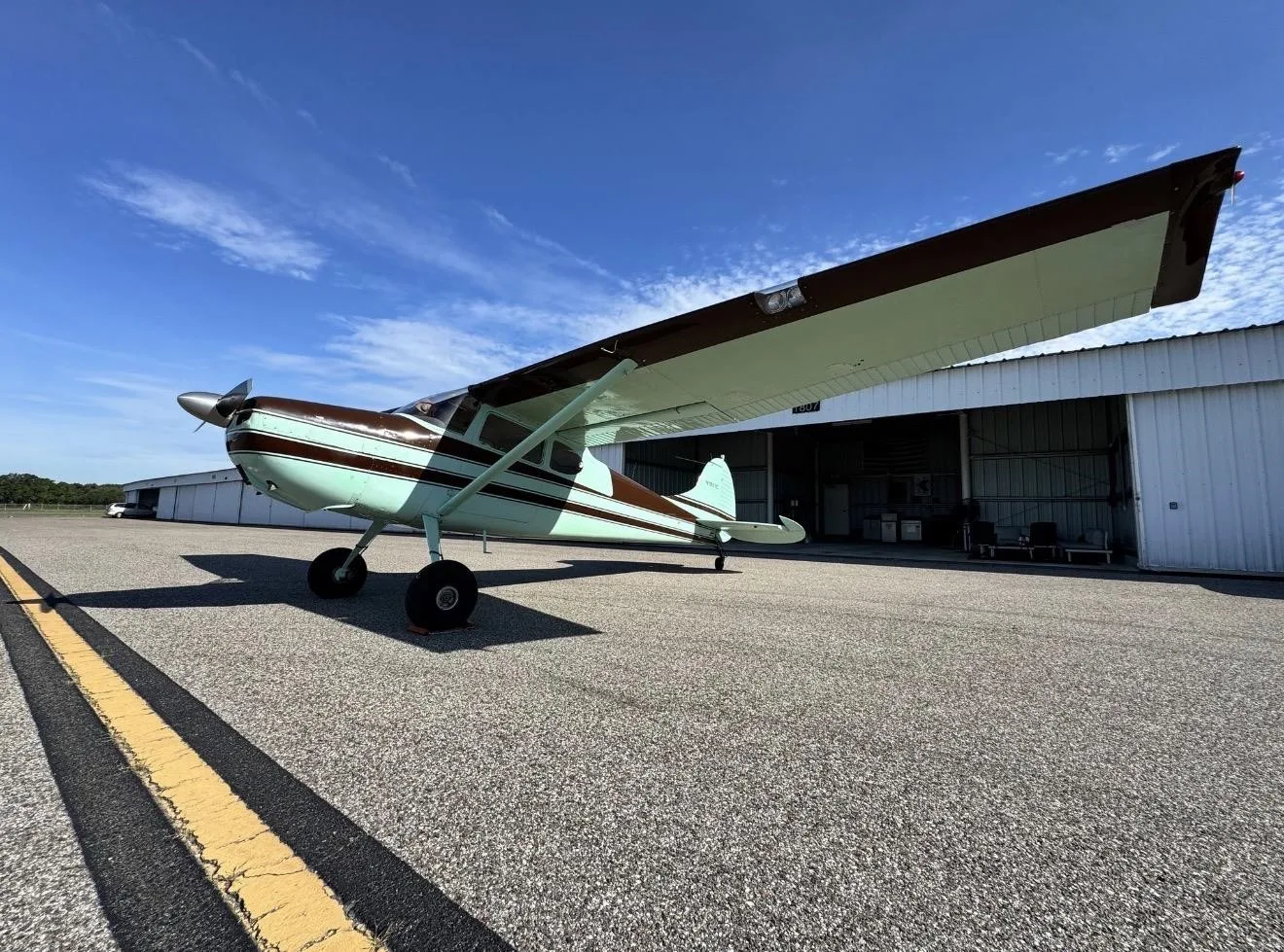
CESSNA 170B for sale now


Free — save the 170B to your watchlist and track it in one place.
More CESSNA 170Bmanuals & documents
See all 41 →- Dynon Certified SkyView HDX Systems DescriptionSystems Description
- Cessna 170 & C305A (USAF O‐1A) T3 Tailwheel Suspension System Installation InstructionsWeight And Balance
- Instructions for Continued AirworthinessSystems Description
- Service Bulletin: SB-001 Rev CService Bulletins
- Component Maintenance Manual for External Design Wheels ...Maintenance Manual
- Instructions for Continued Airworthiness No. ICA17025Weight And Balance
- Technician’s Service GuideTraining Manual
- Emergency ProceduresEmergency Procedures
- FAA PARTS MANUFACTURING APPROVALS (PMA) & SUPPLEMENTAL TYPE CERTIFICATE APPROVALS (STC)Supplemental Type Certificate
- Type Acceptance Report TAR 8/21B/24 – Cessna 170 SeriesMaintenance Manual
- Cessna Flyer - April 2015Other Documents
- FAA Safety BriefingChecklist
If you fly the CESSNA 170B, you may also be researching these.




In this document
Risk Homeostasis: Reducing Risk Does Not Necessarily Reduce Accidents
This section discusses the concept of risk homeostasis, which posits that individuals have a personal threshold for acceptable risk. It explains how pilots may take greater risks when they feel safer due to technology, potentially leading to dangerous situations. The article emphasizes the need for pilots to be aware of their risk tolerance and to make informed decisions based on their abilities and the conditions they face.
Aviation Research at the Advanced Cognitive Engineering Lab
This section outlines ongoing research at the ACE Lab, focusing on cognitive health screening for pilots and the impact of visual illusions in flight simulation. It invites pilots to participate in studies that aim to enhance safety and training methodologies in aviation.
Drone Safety
This section emphasizes the importance of safe drone operation, outlining regulations for drone pilots, including registration and certification requirements. It stresses the need for awareness and adherence to safety protocols to ensure responsible drone use.
Aviation and COVID-19
This section addresses the challenges posed by the COVID-19 pandemic on aviation, detailing measures and guidance from Transport Canada to support stakeholders in maintaining safety while navigating the evolving situation.
Recently Released TSB Reports
This section summarizes recent Transportation Safety Board reports, including incidents involving various aircraft, highlighting the importance of safety awareness and the lessons learned from these occurrences.
Safety notes
- Pilots should not rely solely on technology for safety; thorough pre-flight planning is essential.
- Indecision in critical situations can lead to dangerous outcomes; pilots must be decisive and prioritize safety.
Full document text
A A AV VI IA AT TI IO ON N S S SA AF FE ET TY Y L L LE ET TT TE ER R ISSUE 2/2020 In This Issue... ASL Survey: We Want to Hear From You! Aviation Research at the Advanced Cognitive Engineering Lab Goes Virtual! Risk Homeostasis: Reducing Risk Does Not Necessarily Reduce Accidents T TP P 1 18 85 5E E Cover photo submitted by Bryan Webster ASL 2/2020 2 The Aviation Safety Letter is published by Transport Canada, Civil Aviation. The contents do not necessarily reflect official government policy and, unless stated, should not be construed as regulations or directives. Letters with comments and suggestions are invited. All correspondence should include the author’s name, address and telephone number. The editor reserves the right to edit all published articles. The author’s name and address will be withheld from publication upon request. Please address your correspondence to: Jim Mulligan, Editor Aviation Safety Letter Transport Canada (AARTT) 330 Sparks Street, Ottawa ON K1A 0N8 E-mail: TC.ASL-SAN.TC@tc.gc.ca Tel.: 613-957-9914 Internet: www.tc.gc.ca/ASL Copyright: Some of the articles, photographs and graphics that appear in the Aviation Safety Letter are subject to copyrights held by other individuals and organizations. In such cases, some restrictions on the reproduction of the material may apply, and it may be necessary to seek permission from the rights holder prior to reproducing it. To obtain information concerning copyright ownership and restrictions on reproduction of the material, please contact the Aviation Safety Letter editor. Note: Reprints of original Aviation Safety Letter material are encouraged, but credit must be given to Transport Canada’s Aviation Safety Letter. Please forward one copy of the reprinted article to the editor. Electronic distribution: To subscribe to the Aviation Safety Letter e-Bulletin notification service, visit: www.tc.gc.ca/ASL. Print-on-Demand: To purchase a Print-on-Demand (POD) version (black and white), please contact: The Order Desk Transport Canada Toll-free number (North America): 1-888-830-4911 Local number: 613-991-4071 E-mail: MPS1@tc.gc.ca Sécurité aérienne — Nouvelles est la version française de cette publication. © Her Majesty the Queen in Right of Canada, as represented by the Minister of Transport (2020). ISSN: 0709-8103 TP 185E Table of Contents Page Aviation Safety Letter survey: We want to hear from you! .................................... 3 Risk homeostasis: Reducing risk does not necessarily reduce accidents .............. 3 Aviation research at the Advanced Cognitive Engineering Lab goes virtual! ....... 6 Drone safety is everyone’s responsibility! ................................................................ 7 Aviation and COVID-19: Measures, guidance, and support .................................... 7 Recently released TSB reports .................................................................................... 8 Poster: VFR Flight Into Adverse Weather Can Be Deadly ...........................Tear-off ASL 2/2020 3 Aviation Safety Letter survey: We want to hear from you! Transport Canada (TC) created the Aviation Safety Letter (ASL) to serve the aviation community as a safety and awareness educational tool. We are looking for your feedback as a reader about whether the content is relevant, useful, and meets safety awareness expectations. Your input is important to us so that we can continue to improve the ASL. All responses are anonymous, and data is aggregated for reporting purposes. The survey will take 5 minutes to complete. Risk homeostasis: Reducing risk does not necessarily reduce accidents by Kathy Lubitz, President of the Ultralight Pilots Association of Canada and co-lead of the General Aviation Safety Campaign (GASC) Ultralight Working Group, as printed in the March 2016 issue of the Ultralight Pilots Association of Canada’s (UPAC) Light Flight) This is the third article proposed by the Ultralight Working Group. This working group committed to writing an article for each edition of the Aviation Safety Letter (ASL) to promote safety best practices and culture, not only within the ultralight community, but also within the whole General Aviation community and in an even broader scope, as you will appreciate when reading this article. If you want to learn more or want to be part of a GASC Working Group, contact us at TC.GeneralAviation-AviationGenerale.TC@tc.gc.ca. Risk homeostasis is the theory that every person has an acceptable level of risk that they find tolerable. It was proposed in 1982 by Dr. Gerald Wilde, a professor of psychology at Queen’s University, Ont. Risk homeostasis theory states that, for any activity, people accept a particular level of subjectively evaluated risk to their health and safety in order to gain from a range of benefits associated with that activity. Wilde refers to this level of accepted risk as “target level of risk.” Wilde uses a thermostat as an example of the target level of risk. A thermostat controls the actions of the heating/cooling unit which controls the temperature. This in turn controls the actions of the thermostat. There will be fluctuations in the room temperature, but averaged over time, the temperature will remain stable, unless the thermostat is set to a new target (set point) level. Similarly, the target level of risk is seen as the controlling variable in the cause of the injury rate. The basic strategy of injury prevention should be to reduce the level of risk that people are willing to accept. Variations in skill or environmental conditions can only produce minor and/or short term fluctuations in target risk, not the set target risk. ASL 2/2020 4 If people subjectively perceive the level of risk as relatively low, they may modify their behaviour to increase their exposure to risk. Conversely, if they perceive a higher level of risk, they may exercise greater caution.
Show full textShow less
Risk homeostasis theory is counter-intuitive to the traditional approach to health and safety, in which it is believed that when initiatives don’t work as planned, we just need more or better controls or greater vigilance. Risk homeostasis explains why people don’t always respond as expected to traditional safety initiatives. Instead, they respond to these initiatives according to their own target level of risk. In the risk and safety industry, it is common to try to isolate, focus on, and solve a particular problem or risk with a specific program or initiative. When the concept of risk homeostasis theory is not considered in the development and implementation of such efforts, those initiatives may not work out as planned or expected because of the subjective perceptions of risk, unconscious decisions, and biases and by-products associated with risk homeostasis. Risk homeostasis proposes that rather than more controls, sometimes fewer controls and more motivation might be more effective. When the subjective perception of risk is greater and people make personal decisions about reducing it to an acceptable level (target risk), they will behave and adapt accordingly. The above information is taken mainly from two articles. One is “Risk Homeostasis Theory: an Overview” by Gerald Wilde. The second is “Risk Homeostasis Theory–Why Safety Initiatives Go Wrong” by Dave Collins. Both sources offer the entire articles as well as references and suggested reading. Drivers feel safer with cars that have ABS brakes and four-wheel drive, so they speed up. Smokers feel that “light” cigarettes are better for their health, so they smoke more of them. The requirement that made motorcycle drivers in Ohio wear helmets did not lower the death rate; the rule resulted in drivers feeling safer and an increase in speed and the number of fatalities. In each case, the risk was reduced in one area, so more was accepted in another. Risk homeostasis and flying How does risk homeostasis relate to flying? We accept the risk of defying gravity to take to the skies. We each have our own reasons to fly, just as we each have our own acceptable level of risk. Relying on in-cockpit technology is an example of pilots accepting a higher level of risk. Before these technological advances were available, a pilot needed careful pre-flight planning along with maps and weather briefings. ASL 2/2020 5 Since all of this information is now at a pilot’s fingertips inside the cockpit, many just go without planning, relying on the equipment to let them know if they are going to run into a problem. They feel that the risk of the technology failing is low. Consider the following example. A pilot uses two electronic aids to get to his or her destination: a global positioning system (GPS) with the aircraft’s position on a VFR Navigation Chart (VNC) and weather radar. The GPS tells the pilot where and how high he or she is. The weather radar shows the location of the rain/snow showers the pilot needs to avoid. Because of the low ceiling, the pilot makes the short flight at roughly 200 feet (ft) above ground level (AGL). The pilot is very familiar with the area, knows about the obstructions to avoid, and also has lots of flying experience and a way out if conditions become too bad to continue. The pilot makes it safely to the destination, admitting, however, that he or she probably should not have made the trip. It worked out, but in hindsight, it was risky… Maybe too risky. A word of caution: “getting away with it” also leads to accepting more risk next time. Another example: a pilot with a glass cockpit flies into deteriorating weather because the screen shows that once the aircraft makes it through the bad weather ahead, conditions will improve. The risk is that in-cockpit weather reports lag behind the actual weather by a few minutes (min) or up to to 20 min or more. Plus, a pilot also needs to know the conditions at the destination at the actual time of arrival an hour later. In both examples, the pilots relied on technology to get them safely to their destination. They risked the failure of the technology. Batteries might die and the pilot would have to change them mid-flight and re-start, hopefully with the program intact. A GPS might lose its signal and not keep track of its current location. Weather conditions are not in real time and may not accurately reflect the current situation. There can be software problems. Owners of some older Dynons actually had this happen when a software update initially caused the screens to freeze up during flight. This is reportedly now fixed, and newer models should not have this problem. Accident statistics show that flight into instrument conditions by pilots who are not able to handle the situation causes many serious accidents. The risk tolerance of these pilots does not match their abilities. Five hours of practice “under the hood” for the Private Pilot Licence may give a pilot confidence to continue into deteriorating weather because he or she has had the training to escape from trouble should he or she encounter instrument conditions. Another example involves a pilot making an approach on a marginal runway. The pilot asks, “Can I make it?” Yes? No? Yes? No? The pilot can’t decide. Indecision is the decision; the answer is no. When the outcome is in question, and the risk is right on the edge of what’s acceptable, the decision should be it’s too risky. If you get nothing else from this article, please at least be aware of risk homeostasis and your personal target risk. Recognize it when you find yourself trying to justifying a proposed action or when you have the potentially dangerous attitude that “I’m safe enough”. We must accept that flying is risky. When we defy gravity, things can go wrong and we can get hurt, or worse. The rewards for accepting the risk can be great, but be realistic about your abilities. Keep yourself safe so that every flight has a happy ending. ASL 2/2020 6 Aviation research at the Advanced Cognitive Engineering Lab goes virtual! by Kathleen Van Benthem, Ph.D. and Anya Pejemsky, Research Assistant, ACE Lab, Institute of Cognitive Science, Carleton University The Advanced Cognitive Engineering (ACE) Lab at Carleton University, located in Ottawa, specializes in research regarding transport safety. Specifically, the ACE Lab uses virtual and full- scale flight simulation to investigate foundational principles of cognition and human-machine integration. You will find articles about our work in the Aviation Safety Letter on the topics of prospective memory (Issue 1/2018), situation awareness (Issue 3/2018), diversion management (Issue 4/2018), and electronic flight bags (Issue 1/2019). Given the current physical- distancing restrictions the ACE Lab is seeking volunteers to participate in two upcoming “virtual” studies that will be of interest to the aviation community. The first study represents the next phase of our validation of CANFLY, a cognitive health screening tool for pilots. The main goal of the CANFLY research agenda is to promote flying for as long as safely possible. The CANFLY has shown excellent promise as a tool for identifying cognitive factors associated with risk during flight. For the CANFLY study, participants will answer short questions about situation awareness after watching four short interactive video clips of flight scenarios. Validation on a large scale with pilots across Canada is an important aspect of this phase of the CANFLY research. The second study, “Visual Illusions in Virtual Reality Flight Simulation”, explores the presence and impact of flight-related visual illusions in 3D virtual reality (VR) environments. This study is innovative, as it is seeking licensed pilots who have access to 3D VR systems like the HTC Vive or Oculus Rift. During the study, participants will complete several guided flight scenarios. Your interaction with the researcher will take place via a virtual meeting! The results of this study will provide us with insight into the validity of training and testing pilots for flight illusions using VR systems (which are economical and offer high ecological validity). ACE Lab at Carleton University ASL 2/2020 7 For both studies, pilots of all ages and levels of experience are encouraged to participate. Rather than having pilots attend our physical laboratory, we are modifying our research methods so that data can be collected from pilots in the comfort of their own homes. As always, the data will be completely anonymized: we do not ask for person identifiers, and IP addresses are not trackable through our platform. For further inquiries or to indicate interest in participating in one or both of the upcoming studies you can send a message to CessnaStudy@gmail.com or check out the study links on our website. We thank you for your interest and hope to hear from you soon! Drone safety is everyone’s responsibility! Now that the drone flying season is here, it’s important to fly safely and follow the rules. Drones that weigh between 250 grams and 25 kilograms (kg) must be registered with Transport Canada, and you must possess either a basic or advanced drone pilot certificate to fly. When operating, ensure you fly your drone where you can see it at all times, below 400 feet (ft), and away from bystanders, emergency operations, advertised events, and airports. Drone safety is everyone’s responsibility—fly safe! To learn more, please visit Drone Safety—Transport Canada. Aviation and COVID-19: Measures, guidance, and support Federal, provincial, territorial, and municipal governments have all been taking action to stop the spread of COVID-19. The landscape is evolving quickly and Transport Canada knows that this has raised many questions and challenges for aviation in Canada. Transport Canada Civil Aviation (TCCA) recognizes the challenges you are encountering during these unprecedented times and has been working to put measures in place to provide some relief to you, our stakeholders, while managing safety risks. TCCA continues to work towards the issuance of additional exemptions and guidance. To consult the complete list of COVID-19 measures, updates, and guidance issued by Transport Canada please visit the website ASL 2/2020 8 Recently released TSB reports The following summaries are extracted from final reports issued by the Transportation Safety Board of Canada (TSB). They have been de-identified. Unless otherwise specified, all photos and illustrations were provided by the TSB. For the benefit of our readers, all the occurrence titles are hyperlinked to the full report on the TSB Web site. —Ed. TSB Final Report A19W0095—Collision with water On 21 July 2019, at approximately 13:00, the pilot and the passenger arrived at Jasper Airport to prepare the Cessna 150J aircraft for a flight to Hinton/Entrance Airport, Alta. The aircraft took off to the northwest on Runway 31 at 13:23, continued climbing for 25 seconds, and reached an altitude of approximately 150 feet (ft) above ground level (AGL). At 0.5 nautical miles (NM) from the airport, the aircraft stalled and entered a spin to the left, and impacted the water in a pool of the Athabasca River. Immediately following the accident, a pilot at the airport who had seen the accident called 911 on his personal cellphone. Another eyewitness drove to the scene within minutes of the impact and assisted both the pilot and the passenger to shore. A number of passersby on Highway 16 stopped to administer first aid, and Jasper Emergency Medical Services responded shortly afterward. The pilot, who was severely injured in the accident, was transported to Edmonton by air ambulance. The passenger was fatally injured. All of the major components of the aircraft were accounted for at the accident site. The wing flaps were found in the retracted position. The aircraft was within the certified weight and balance limits. Based on examination of the wreckage and the photo and video information collected, it was determined that the engine and flight controls had been operating normally prior to impact. Environment and Climate Change Canada’s Jasper Warden station, located 5 NM south of the accident site, records hourly weather information. The information recorded at 13:00 indicated the following: Wind direction variable at 1 to 3 knots (kt) Temperature 24.4 °C, dew point 6.5 ° Cessna 150J wreckage involved in the July 2019 accident in Jasper, Alberta. ASL 2/2020 9 An aviation routine weather report (METAR) for Edson Airport, located 68 nm northeast of the accident site, recorded the following weather at 1300: Wind direction 104° magnetic at 11 kt, gusting to 17 kt Visibility greater than 9 statute miles (SM) Temperature 22 °C, dew point 6 °C Altimeter setting 30.13 inches (in.) of mercury At the time of takeoff, the winds at Jasper Airport were southerly at 5 to 10 kt, and the density altitude, based on the altimeter setting at Edson Airport, was 5 088 ft above sea level (ASL). The aircraft was equipped with a Garmin GPSMAP 196. It was recovered at the accident site and was sent to the TSB Engineering Laboratory for analysis. Just before the loss of control, the GPS (global positioning system) recorded a reduction in ground speed from 83 mph to 64 mph and a course change approximately 30 degrees to the left of the runway track. During the reduction in airspeed, the altitude remained constant at about 150 ft AGL for almost 5 seconds before the aircraft departed controlled flight and entered the aerodynamic stall and left-hand spin. Map showing the location of the occurrence Cessna 150J wreckage upon recovery from the Athabasca River in Jasper, Alberta. ASL 2/2020 10 TSB Final Report A19W0063—Loss of control and collision with terrain after takeoff Background The privately owned Cessna 170B was being flown on a ferry flight from Flying Cloud Airport (KFCM), Eden Prairie, Minnesota, United States (U.S.), to Ted Stevens Anchorage International Airport (PANC), Anchorage, Alaska, U.S. On board were the new owner of the aircraft, who had recently purchased it, and a second pilot. The new owner of the aircraft was also using this ferry flight to meet the requirements to obtain a tailwheel endorsement in accordance with the U.S. Federal Aviation Administration’s regulations. The second pilot was a certified flight instructor who was able to authorize the endorsement. On 24 May 2019, the 2 pilots travelled together to KFCM. After having been delayed due to weather for the better part of the day, they loaded the aircraft with the gear they intended to transfer to PANC. The aircraft then taxied to the runway. During takeoff, controllability issues were encountered, and the takeoff was rejected. The investigation was unable to determine the nature of the controllability issues. The aircraft taxied back to the hangar, and the gear was unloaded. The 2 pilots completed 3 circuits at KFCM in the empty aircraft. Once they had landed, approximately half of the gear was reloaded. The rest of the gear was left behind to be sent to Alaska by other means. It was then decided to delay the departure until the next day. On 25 May 2019, the day’s flight began at KFCM and ended at Coutts/Ross International Airport (CEP4), Alta. On 26 May 2019, the flight continued across Alta. and ended at Fort St. John Airport (CYXJ), B.C. Figure 1. Diagram depicting the occurrence ASL 2/2020 11 History of the flight On 27 May 2019, the aircraft departed CYXJ and, after stopping at Fort Nelson Airport (CYYE), B.C. and Watson Lake Airport (CYQH), Y.T. for fuel, the aircraft landed at Whitehorse/Erik Nielsen International Airport (CYXY), Y.T. At approximately 17:20, after the aircraft had been refuelled and the flight plan had been filed, the second pilot, who was the pilot flying and was seated in the left seat, taxied along Taxiway F to Runway 14R. Before departure, the pilot flying discussed the variability of the wind speed and direction with the tower controller. The tower controller indicated that the winds at the end of runway where the take-off run would be initiated were 210° magnetic (M) at 15 knots (kt), gusting to 20 kt. The windsock at the other end of the runway indicated that the winds were calm. After entering Runway 14R from Taxiway F, the pilot flying taxied down the runway and positioned the aircraft for takeoff on the very left side of the runway, approximately 2 200 feet (ft) down the runway. He then steered the aircraft diagonally to the right to allow for a more into-wind take-off run. At 17:28, when the aircraft was cleared for takeoff, the winds were still 210°M at 15 kt, gusting to 20 kt. The pilot flying started the take-off run with 7 300 ft of runway remaining. The aircraft became airborne with 5 800 ft of runway remaining. The pilot flying put the aircraft into a right- wing-low attitude, which was maintained in varying degrees throughout the takeoff, and the aircraft climbed slowly. With 3 400 ft of runway remaining, the pilot flying lowered the flaps from 0° to 40°. With 2 900 ft of runway remaining, the pilot reduced the flap setting to either 30° or 20° where they remained; the exact setting could not be determined. With 2 300 ft of runway remaining, the aircraft entered the area of calm wind as indicated by the limp windsock. With 900 ft of runway remaining, after reaching approximately 50 ft above the runway surface, the aircraft began an uncommanded descent. Accident site approximately 2000 ft south of Runway 14R at the Erik Nielsen Whitehorse International Airport (CYXY), Yukon ASL 2/2020 12 At 17:30:15, when the aircraft was approximately 150 ft beyond the end of the runway, it struck the ground near the perimeter road, bounced, and cleared the airport fence, beyond which is a 120-ft drop-off. When the aircraft was just past the fence, its stall warning horn sounded. The aircraft stalled, and the left wing dropped. There was a very brief recovery and the stall warning horn ceased; however, the recovery was quickly followed by a secondary stall, and the aircraft rolled abruptly to the right and departed controlled flight. At 17:30:25, the aircraft crashed into a wooded area and was severely damaged. An on-board video recorder continued to record both audio and video after the aircraft had come to rest. Based on the audio, electric power was still on after the crash because a beeping sound could be heard. A fire erupted 10 seconds after impact and eventually consumed the aircraft. Both occupants were fatally injured. The emergency locator transmitter was activated during the crash sequence. Weather information The hourly aerodrome routine meteorological report (METAR) for CYXY at 17:00 was as follows: wind 200° true (T) at 12 kt, gusting to 19 kt visibility 40 statute miles (SM) few clouds at 8 000 ft above ground level (AGL) few clouds at 13 000 feet AGL temperature 24 °C dew point 4 °C Aircraft information Records indicate that the aircraft was certified, equipped, and maintained in accordance with existing regulations and approved procedures. Pilot information The pilot flying on the occurrence flight held a U.S. commercial pilot certificate with the following ratings: single-engine land, single-engine sea, and airplane instrument. He also held a flight instructor rating. His pilot logbook was destroyed in the post-impact fire; however, the investigation was able to determine that up to April 2019, he had accumulated 9 563 hours (hr) total flight time. Training records from his employer showed that he had experience on Cessna 185 aircraft, on Cessna 206 aircraft, and on de Havilland DHC-2 Beaver aircraft on floats, skis and wheels. The new owner of the aircraft was an ex-military helicopter pilot who held a U.S. commercial pilot certificate with the following ratings: airplane single- engine land, rotorcraft–helicopter, and airplane and helicopter instrument. Image capture of the takeoff (at 17:29:38). The red arrow points to the windsock at the far end of Runway 14R, indicating calm winds. (Source: Video recorder installed on the aircraft involved in the occurrence, with TSB annotation) ASL 2/2020 13 He had accumulated approximately 1 400 hr total flight time. Of those 1400 hr, 1240 hr were on helicopters and 160 hr were on single-engine fixed-wing aircraft. Airport information The airport is at an elevation of 2 317 ft above sea level (ASL) and, according to the NAV CANADA Local Area Weather Manual: The Weather of the Yukon, Northwest Territories and Western Nunavut, is surrounded by mountains “reaching heights of over 6,000 feet [ft] ASL at 15 nautical miles [NM] to the southwest, 7 miles [mi.] to the east, and 30 miles [mi.] to the northwest of the airport.” The airport frequently experiences wind that is created by a combination of valley effects and regional pressure gradients: more specifically, “[…] strong overriding west to southwest winds aloft will generate more significant and widespread turbulence with directional shear appearing within a thousand feet [ft] of surrounding mountain top elevations.” Wreckage information Although the post-impact fire had consumed the entire aircraft, the investigation was able to retrieve some documents and a video recorder from the wreckage. The video recorder was sent to the TSB Engineering Laboratory in Ottawa, Ont. for examination and analysis. A cursory inspection of the engine was carried out at the accident site and compression in the cylinders was confirmed. Due to the impact damage and the post impact fire, the investigation could not conclusively identify any issue that would have prevented the engine from producing full power. Inspection of the airframe to determine flight control continuity was not possible due to fire damage; however, video retrieved of the occurrence flight showed the aircraft responding to flight control inputs. Aircraft performance Due to the extent of the post-impact fire, the investigation could not determine the aircraft’s precise take-off weight on the occurrence flight; however, based on information collected, it is likely that the aircraft was at least at the gross take-off weight of 2 200 pounds (lbs). The density altitude at the time of departure was calculated to be 4 069 ft ASL with a headwind component of 5 kt at the beginning of the take-off run. The Cessna 170B performance chart indicates that the take-off distance required at CYXY with a temperature of 24 °C (80 °F) and with flaps up would be 936 ft to become airborne and 2 340 ft to clear a 50-ft obstacle. The Cessna 170B performance chart also indicates that, at a gross weight of 2 200 lbs and with flaps up, the aircraft should have achieved a climb rate of 580 ft per minute (min). From the time full power was applied, the aircraft used about 1 600 ft to become airborne and never climbed above 50 ft during the entire takeoff. As explained in the Cessna 170B owner’s manual, “[t]he flaps supply added lift and considerable drag […].” The manual also states that “[t]he use of flaps is not recommended for cross-wind take-offs.” The manual states the following with respect to using flaps at higher-density altitudes: […] as altitudes and outside air temperatures increase, drag off-sets lift until eventually the use of flaps increase the take-off distance. It is recommended that the take-off chart […] be consulted to determine whether the use of flaps is desirable for take-off. […] 30 and 40 degree flaps are not recommended at any time for take-off. ASL 2/2020 14 REMEMBER—Don t, under marginal conditions, leave flaps on long enough that you are losing both climb and airspeed. The Cessna 170B performance chart indicates that landing performance at CYXY at approximately 24 °C (80 °F) using 40° of flap requires 1 245 ft total to land over a 50-ft obstacle. Of that distance, 747 ft is in the air, and the remaining 498 ft is the rollout after landing. In this occurrence, the distance available from the point at which the descent started to the perimeter fence was about 1 000 ft. Safety messages In this occurrence, after becoming airborne, the aircraft did not climb above 50 ft, and a right-wing-low attitude was maintained on the departure climb. As well, the flaps were set to 40° and then to either 30° or 20°, which would have increased drag. The Cessna 170B owner’s manual clearly states that the use of flaps at higher- density altitudes is not recommended. It is important to follow aircraft manufacturers’ recommendations to ensure the aircraft performs as designed. In addition, the investigation was unable to determine why the takeoff was continued through a performance- decreasing wind after the aircraft was unable to climb. If the aircraft is not performing as expected during takeoff and there is sufficient runway remaining to bring the aircraft to a stop, pilots should consider discontinuing the takeoff. TSB Final Report A19A0052—Collision with water History of the flight On 15 July 2019, the float-equipped de Havilland DHC-2 MK I Beaver aircraft was conducting a day trip under visual flight rules from a fly-in fishing lodge on Crossroads Lake, N.L., to Mistastin Lake, N.L. A pilot and 6 passengers were on board. The purpose of the flight was to travel to Mistastin Lake for a day of fishing. Mistastin Lake is approximately 16 kilometres (km) by 11 km in area and over 200 feet (ft) deep in places, and is accessible only by air. There was some fog and mist in the morning, and the flight was delayed leaving the lodge, departing between 09:00 and 09:30. When the aircraft did not return to the lodge in the evening, staff attempted to communicate with the aircraft through a radio at the lodge, and also through Air Saguenay's dispatch in Wabush, Que. When no communication was established, the company implemented its emergency procedure and first contacted the Joint Rescue Coordination Centre (JRCC) in Trenton at 20:38. A search and rescue effort was initiated. Search efforts Once JRCC was contacted, a military search and rescue (SAR) aircraft was dispatched from Greenwood, N.S., which arrived over Mistastin Lake at around 02:00 on 16 July. At around 05:00, the SAR aircraft spotted the occurrence aircraft's fuselage floating in the water. Throughout the day, more SAR aircraft, both fixed wing and helicopter, as well as a contracted aircraft, conducted searches in the area for survivors. The bodies of 3 passengers were recovered from the water, the temperature of which was 6 °C to 7 °C. The search continued until around 21:00, when the last helicopter departed from the scene. On 17 July, the RCMP (Royal Canadian Mounted Police) recovery team organized the logistics of transporting personnel and equipment to the site due to its remote location. ASL 2/2020 15 On 18 July, the recovery team was unable to travel to the occurrence site because of poor weather. On 19 July, when the recovery team arrived on site, the wreckage was no longer visible on the surface of the water. In the following weeks, extensive efforts by the RCMP, later assisted by the military, were conducted to locate and retrieve the other 4 occupants. On 24 July, the body of a fourth passenger was recovered. None of the 4 passengers were found wearing personal flotation devices. The search ended on 08 August 2019. The recovery team did not locate the remaining occupants or the wreckage. The pilot and the 2 other passengers are still missing. The RCMP continues to fly over the area when possible. Aircraft information The DHC-2 Beaver is type certificated for a maximum of 8 occupants: 2 in the front, 3 in the centre, and 3 in the rear. The occurrence aircraft was configured for 7 occupants, with the rear seat seating 2. No anomalies were noted in a review of the aircraft's maintenance records. Figure 1. Map showing location of lodge and destination of the occurrence flight (Source: Google Earth, with TSB annotations) ASL 2/2020 16 The aircraft was equipped with a 406 MHz emergency locator transmitter; however, no emergency locator transmitter signal was received. Pilot information Records indicate that the pilot was certified and qualified for the flight in accordance with existing regulations. The pilot completed the annual required company training, including recurrent annual flight training. The pilot had often flown the route from the lodge to Mistastin Lake. Wreckage information The wreckage observed floating on the water during the first day of recovery consisted of the fuselage and empennage of the aircraft. When first discovered, the fuselage was inverted and partially submerged. The engine, wings, and floats had detached from the fuselage and were not visible. Weather information There is no weather station on Mistastin Lake. The nearest weather station to Mistastin Lake is in Nain, N.L., located about 75 nautical miles (NM) to the east of the lake. Nain is located on the Atlantic coast, which can affect its weather and thus its weather reporting may not be reflective of weather inland. The weather in Nain throughout the day was light winds, visibility of 15 statute miles (SM), a few clouds at 1 000 ft above ground level (AGL) that dissipated in the morning, and a broken ceiling of around 2 000 ft AGL for the majority of the day. According to the graphic area forecast (GFA), at 09:00, the area surrounding northern Labrador was forecasted to have overcast layers between 3 000 and 18 000 ft AGL and greater than 6 SM visibility, with isolated altocumulus castellanus at 22 000 ft and 5 SM in light rain showers, mist, ceilings 800 ft AGL, and patchy ceilings 500 ft to 1 000 ft AGL. At 15:00, the forecast for the area was similar except that the isolated altocumulus castellanus areas would encounter ceilings at 1 200 ft AGL. The 2 100 GFA was similar to the 1 500 GFA. Figure 2. Wreckage of occurrence aircraft (Source: RCMP) ASL 2/2020 17 Next steps The aircraft had been seen floating in Mistastin Lake and later sank. To date, the wreckage has not been found. There is no radar coverage at low altitudes in the area, and the aircraft was flying in uncontrolled airspace and not in communication with air traffic services. Without any witnesses and without key pieces of the aircraft, the TSB is unable to conduct a full investigation into this accident. If the aircraft is found, the TSB will assess the feasibility of investigating the accident further. TSB Final Report A19C0053—Collision with terrain History of the flight On 28 May 2019, at approximately 15:03, the pilot of a privately owned, float-equipped Piper PA-12S Super Cruiser advised Kenora Radio of his intention to depart westbound from a private dock located on Red Lake, Ont. The pilot, who was sitting in the front seat, was on a visual flight rules (VFR) flight to Domain Lake, Ont. The purpose of the flight was to transport passengers from an outpost camp at Domain Lake to a second outpost camp at Optic Lake, Ont. The passengers were employees of the pilot, who owned both the aircraft and the outpost camps. Just before departing from Red Lake, the pilot sent a flight itinerary by text message to a responsible person. The intended route of flight was from Red Lake to Domain Lake, then to Optic Lake, back to Domain Lake, then back to Optic Lake, and finally returning to Red Lake by 21:30 (Figure 1). At 15:05, Kenora Radio advised the pilot that the current wind at the Red Lake Airport (CYRL), Ont. was 240° magnetic at 10 knots (kt) gusting to 19 kt and that the altimeter setting was 29.69 inches of mercury (inHg), and Figure 1. Overview of intended flights ASL 2/2020 18 then instructed the pilot to call once airborne. At 15:08, the pilot reported being airborne. At 15:14, the pilot advised that the Piper PA-12S was clear of the control zone to the west at 2000 feet (ft) above sea level (ASL). The pilot landed at Domain Lake at approximately 16:00, and taxied to the outpost camp. Subsequently, the pilot and the 1 st passenger departed for Optic Lake, leaving the 2nd passenger at the camp. At approximately 17:30, canoeists saw the aircraft land on Optic Lake. As the canoeists continued their journey around the shore of Optic Lake, they experienced difficult paddling conditions due to strong southwesterly winds and high waves (Figure 2). The aircraft remained at Optic Lake and, at approximately 20:15, the canoeists heard an aircraft departing Optic Lake. The pilot returned to Domain Lake on his own, picked up the 2nd passenger, and subsequently departed Domain Lake for Optic Lake. At 21:24, the canoeists saw a plume of smoke to the northwest, toward Domain Lake. At 21:50, the pilot had not yet checked in with the responsible person, who then advised the pilot’s business partner that the flight was overdue. The next morning, at approximately 06:30, the business partner went to the pilot’s home and determined that the Piper PA-12S was not at the dock. At approximately 08:30, the business partner and a second person flew in a private aircraft from Red Lake/Howie Bay (CKS4) to Domain Lake, and saw that the Piper PA-12S had collided with trees and terrain, and that a forest fire was burning near the crash site. At 09:06, Red Lake Fire Management Headquarters (FMH) dispatched a fire ranger crew and a helicopter to the area where the smoke had been observed. Red Lake FMH advised the Ontario Provincial Police of a downed aircraft at 09:50 and contacted Joint Rescue Coordination Center (JRCC) Trenton at approximately 10:30. No emergency locator transmitter (ELT) signal had been received by JRCC Trenton. The Ontario Provincial Police subsequently attended the scene and determined that both aircraft occupants had been fatally injured. Pilot information Records indicate that the pilot-in-command was certified and qualified for the flight in accordance with existing regulations. Figure 2. Choppy water on Optic Lake at 17:11 ASL 2/2020 19 Aircraft information The occurrence Piper PA-12S had approximately 5 235 hours (hr) of total airframe time and was maintained to the standard established in Canadian Aviation Regulations (CAR) 625 appendices B and C. The aircraft was equipped with numerous supplemental type certificates (STC), modifications, and Engineering Orders that included: Installation of Lycoming 0-320-A2B engine (STC-SA83AL) Installation of McCauley 1A175-GM8241 propeller (STC-SA279AL) Installation of Piper Model PA-18 wing flaps (STC-SA578AL) Installation of Piper PA-18-type elevator control system Installation of new sealed struts (AD 93-10-06) Baggage compartment extension Battery relocation and electrical system modification On 05 May 2013, the aircraft was installed on floats in accordance with Piper float drawing 11031 that indicated the installation of a ventral fin. A ventral fin is used to increase directional stability of an aircraft. The ventral fin can be replaced with rudder centering cables in accordance with STC SA289AL. However, neither a ventral fin nor rudder centering cables were installed at the time of the accident. Figure 3. Accident site ASL 2/2020 20 The aircraft was equipped with a 406 MHz ELT that was installed in the cockpit. Due to fire damage, it could not be determined if the ELT switch was in the on, armed, or off position. Weight and balance The aircraft had an empty weight of 1 378 pounds (lbs) and a maximum take-off weight of 1 838 lbs on floats. The investigation was unable to determine how much fuel was on board the aircraft and whether it was within the specified weight and center of gravity limitations at the time of the accident. Weather information The investigation was unable to determine whether the pilot reviewed any aviation weather information before the flight. Aviation weather forecasts available before the pilot departed show that the Red Lake area was forecasting westerly surface winds at 15 kt gusting to 25 kt, with moderate mechanical turbulence from the surface to 3 000 ft ASL. At 15:00, the weather at CYRL was wind 260°T at 11 kt gusting to 19 kt, visibility 15 statute miles (SM), scattered clouds at 6 400 ft above ground level (AGL), broken clouds at 20 000 ft AGL, temperature 19°C, dew point 4°C, altimeter setting 29.69 inHg. The gusty wind conditions continued until at least 20:00. Reports from 2 pilots in the Red Lake area described the weather conditions in the late afternoon as violently windy and, as a result, they chose not to fly for the remainder of that day. At 17:26, an indication of the intensity of the mechanical turbulence occurred 115 nautical miles (NM) southeast of CYRL at Sioux Lookout, Ont. A Beech 1900 experienced a loss of 20 kt airspeed in low-level wind shear at 500 ft AGL on final approach. NAV CANADA transmitted an urgent pilot weather report (PIREP) on the Flight Information Service En route (FISE) at 17:31 for the Sioux Lookout, Kenora, and Red Lake areas. The investigation was unable to determine whether the pilot heard the urgent PIREP broadcast. At 21:00, the weather at CYRL was wind 300°T at 5 kt, visibility 15 SM, sky clear, temperature 17°C, dew point −4°C, altimeter setting 29.68 inHg. On 28 May 2019, the sunset occurred at 21:19 at Domain Lake, and the end of civil twilight occurred at 22:02. Wreckage and impact information The aircraft collided with trees and terrain on the shore of Domain Lake (Figure 3, see p.19) on a southeasterly heading, with a nose-down attitude of approximately 30 °. The aircraft struck trees and then a granite rock at an elevation of 1 394 ft ASL. Before impacting the granite rock, the propeller cut through a tree, indicating that the propeller was rotating and that the engine was producing substantial power at the time of impact. An inspection of the airframe for any pre-impact anomalies was inconclusive due to the damage sustained on impact and in the post-impact fire. ASL 2/2020 21 TSB Aviation Safety Study SSA93001 An Aviation Safety Study released by the TSB in 1994 observed that airplanes which are most frequently float equipped, such as the Piper Cub “derivatives” (J3, PA11, PA12, PA14, PA18, PA20, PA22), Cessna 172, Cessna 180, Cessna 206, Beaver, and Otter, have more fatal accidents on floats than on wheels. The study found that pilots with less than 100 hr on a give undercarriage configuration accounted for 38% of the accidents studied. This 38% was split between pilots with less than 100 hr of landplane experience (17% of accidents) and those with less than 100 hr of floatplane experience (21% of accidents). The study pointed out that the 4 percentage point difference suggests that recently trained seaplane pilots may not be adequately prepared to operate that type of aircraft since they account for a higher proportion of accidents than their landplane counterparts even though they probably had acquired more total flying experience, since the majority of such pilots had landplane flying experience before upgrading to floats. Safety message Pilots should consider their abilities, experience, and the aircraft’s capabilities when planning and conducting flights, especially when gusty surface winds and moderate turbulence are forecast along the route of flight. Figure 4. Accident site near the shore of Domain Lake, Ontario It’s better to arrive a little late in this world, than early in the next! VFR FLIGHT INTO ADVERSE WEATHER CAN BE DEADLY . canada.ca/general-aviation-safetyTP 2797E
What's in the CESSNA 170B TCDS
A Type Certificate Data Sheet (TCDS) is the FAA's record of what an aircraft type was approved as. It is the source of truth for weights, seating, fuel and the rules the design was certified against. Expand any line to see what it means.
261 CESSNA 170B parts for sale
See all →


Parts listed for sale by vetted eBay sellers — confirmed on eBay at checkout.